The Orlando, Florida, USA, region is thinking big when it comes to economic and community development. It unveiled a digital twin that uses 3D technology to map 800 square miles of the region, recreating 40 square miles in high fidelity. One of the most comprehensive regional representations in existence, the project began in 2021 and is now in use by the Orlando Economic Partnership (OEP) to demonstrate the area’s value proposition to companies considering the four-county Orlando region for relocation or expansion.
Virtual Orlando
The 160-square-foot digital twin incorporates holographic elements to highlight priority areas for economic development in high resolution. Economic development project managers offer business executives demonstrations of the twin, controlling the experience via a tablet and providing a unique experience to each visitor. OEP staffers are trained to navigate the digital twin to present relevant data layers and information, including demographics, infrastructure, quality-of-life amenities, utilities, and transportation. The twin incorporates data sets owned by OEP, licensed from others, and public data from a variety of sources.
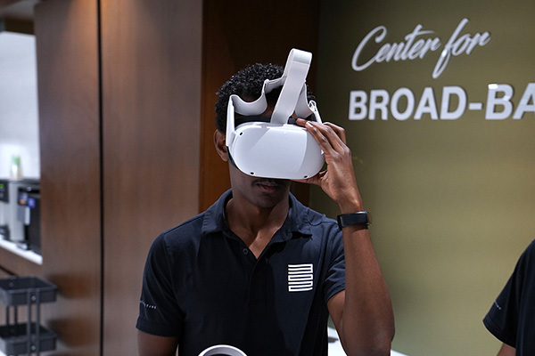
The digital twin can also be viewed and interacted with using a Meta Quest virtual reality (VR) headset (see Figure 1). This device gives OEP staffers a way to bring the digital twin on the road, allowing executives to see, without leaving their offices, what it would be like to live and work in Orlando. Reactions to the VR demonstration have been overwhelmingly positive, with executives noting the contrast between viewing data-filled PowerPoint slides and looking at a virtual representation of the region.

The 800-square-mile map highlights five geographic areas: downtown Orlando, Lake Nona, the Central Florida Research Park in Orange County, Lake Mary-Heathrow in Seminole County, and NeoCity in Osceola County. The digital twin helps the Orlando region stand out to site selectors and corporate CEOs by highlighting developable land, available real estate, areas of interest for a variety of industries, infrastructure connectivity, and talent availability.
OEP has learned that when a company is making a relocation or expansion decision, its planners typically visit three to 10 cities. The digital twin helps executives, consultants, site selectors, and community partners better understand the Orlando region without having to spend multiple days in a car.
Orlando’s digital twin could be viewed as a more in-depth version of Google Maps. During demonstrations, site selectors and business leaders can experience a “flyover” of the region with overlays of relevant data points. They can also view heat maps with demographic information, transit routes, rail spurs, and fiber optic cable connections.
Next Steps
Orlando’s digital twin currently incorporates operational and sensory data; future versions will include scenario mapping and machine learning. Plans also call for the twin to be stored in the cloud, allowing for access from outside the marketing center. OEP leaders see the digital twin as the foundation for a platform that will serve as a critical resource for decision makers in the area and play a vital role in Orlando’s economic future and smart city planning. For example, stakeholders could use the digital twin to simulate climate change mitigation projects based on historical rainfall totals and flooding patterns. Decision makers could predict traffic bottlenecks using sensor data from stoplights and highways, informing transportation planning. City planners could use historical population data to predict future density for use in transit mapping, housing development, and power grid expansion.
[For more on virtual Orlando, see: “Orlando’s Digital Twin Has Potential to Influence Regional Planning.”]


